Hiking route From the historical ruin of Reifenstein to the Sauerbrunn spring at Thalheim Castle - Touren-Impression #1 | © Markus Beren Hiking route From the historical ruin of Reifenstein to the Sauerbrunn spring at Thalheim Castle - Touren-Impression #1 | © Markus Beren

From the historical ruin of Reifenstein to the Sauerbrunn spring at Thalheim Castle

Open
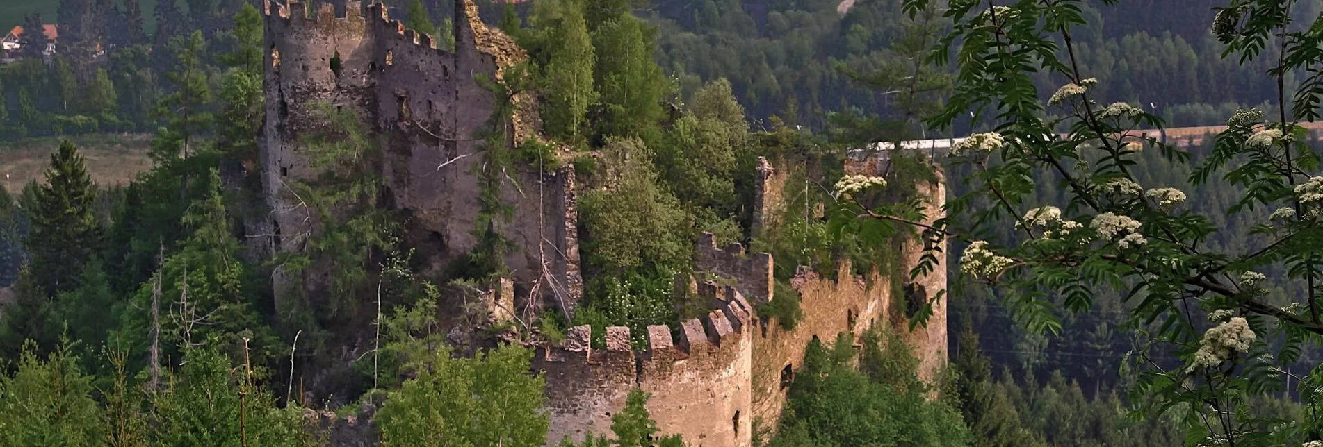
Use the tour to escape from everyday life and explore the ruin Reifenstein from the outside. Entering the ruins is prohibited, as the ruin is in great danger of collapse. Furthermore, they explore the castle Thalheim-Sauerbrunn already known in ancient times Sauerbrunnquelle and other nearby mineral water springs. 
On the road...With respect for wildlife and the environment!

In the Pölstal, special emphasis is placed on the preservation of unspoiled nature. So that the pleasure of the people does not become a problem for wild animals and nature, it requires consideration measures. For the sake of nature and the environment, correct behavior in the mountains is the top priority for the hiking enthusiast.

- Use the designated parking areas

- Do not block access roads and please respect local driving bans

- Observe information boards at the starting points and stick to the recommended marked routes

- Avoid approaching wildlife


Characteristics

Skill
Fitness

Best season

The tour in numbers

medium
Level of difficulty
13,0 km
Route
3:30 h
Time
410 hm
Uphill
410 hm
Downhill
1060 m
Highest point

Map & downloads

More information

Coming from the S36, turn off at St. Peter ob Judenburg and follow the B114 to Pöls.

Coming from the A9, turn off at Trieben and follow the B114 to Pöls.

The tour starts either at the market town of Pöls-Oberkurzheim or at the Poier car dealership and leads through Pöls along the Reifensteiner Straße to the Meierei, here the bridge crosses the Pölsbach. After the underpass past the ruins of Reifenstein following hiking trail 6, you reach the south side of the Falkenberg where hiking trails 6 and 14 cross. Here we change to hiking trail 14 and follow it along a forest road to the district of Thalheim. From Thalheim we then hike in the direction of Thalheim-Sauerbrunn Castle, which was already known in ancient times for its mineral water from the Sauerbrunn spring. From here we return to the respective starting points.
Refreshment stops:

GH Überer, GH Köck, Cafe-Bakery Brandl, Cafe l'Angole, Cafe Living, Biobadeteichkiosk Pöls, Murtaler Pizza-Kebap, GH Widenschek

Information on public transportation can be found at www.verbundlinie.at 
You can park right next to the Poier car dealership or at the municipal office in Pöls-Oberkurzheim
More information at

www.murtal.at

You can also find this tour on the following hiking map:

Region Murtal - Hiking map 1 & 3 - Tour 6a

The hiking maps 1,2&3 - you can get for free at the tourism association Murtal - info@murtal.at  - Tel.: +43 3577 26600

You can also find more information about the region on - www.murtal.at 

You can also find this tour on the following hiking map:

Region Murtal - Hiking map 1 & 3 - Tour 6a

The hiking maps 1,2&3 - you can get for free at the tourism association Murtal - info@murtal.at  - Tel.: +43 3577 26600

You can also find more information about the region on - www.murtal.at 

Gallery

What the weather will be like

Mariazell (860m)

Morning
foggy
8°C
85%
5 km/h
Noon
weather.icon.66
10°C
90%
5 km/h
Night
weather.icon.66
8°C
85%
5 km/h
Throughout the day more and more rain with hardly any breaks.
Morning
cloudy
8°C
40%
5 km/h
Noon
weather.icon.04
16°C
20%
5 km/h
Night
slightly cloudy
12°C
35%
5 km/h
Rather cloudy in the morning, then sunny spells will develop gradually.
05.05.2024
cloudy
6°C 19°C
06.05.2024
sunny
7°C 19°C
07.05.2024
foggy
8°C 15°C

Nearby accommodation options

Continue to search

You may also be interested in

Recommended tours

Accessible by public transport
Rast- und Aussichtplatz mit Blick auf die Kirche in Oberzeiring | Weges OG | © Weges OG
Accessible by public transport
Ab den Ortsteil Dietersdorf sind wir am Weitwanderweg 08 unterwegs | Weges OG | © Weges OG
Murtal medium Open
Route 11,6 km
Duration 3:30 h

Kumpitz circular hiking trail

Accessible by public transport
St.Georgen im Hintergrund | Weges OG | © Weges OG
Murtal medium Open
Route 12,7 km
Duration 4:00 h

Gerschkogel

Accessible by public transport
Unsere Wanderung beginnen wir bei der Kirche | Weges OG | © Weges OG
Murtal medium Open
Route 10,3 km
Duration 3:30 h

Habring from Oberzeiring via Bauernhof vlg. Friday

Accessible by public transport
Kurze Rast unterwegs | Weges OG | © Weges OG
Murtal medium Open
Route 14,7 km
Duration 5:00 h

Habring via Nußmoaralm

Accessible by public transport
Hinter dem Kurzentrum beginnt unser Wanderweg | Weges OG | © Weges OG
Murtal easy Open
Route 6,0 km
Duration 2:00 h

Oberzeiring - circular hike to the transmitter

Accessible by public transport
Ringkogel | Wolfgang Mitteregger | © Wolfgang Mitteregger
Gaal challenging Open
Route 19,3 km
Duration 7:30 h

Großer Ringkogel starting from Gaal