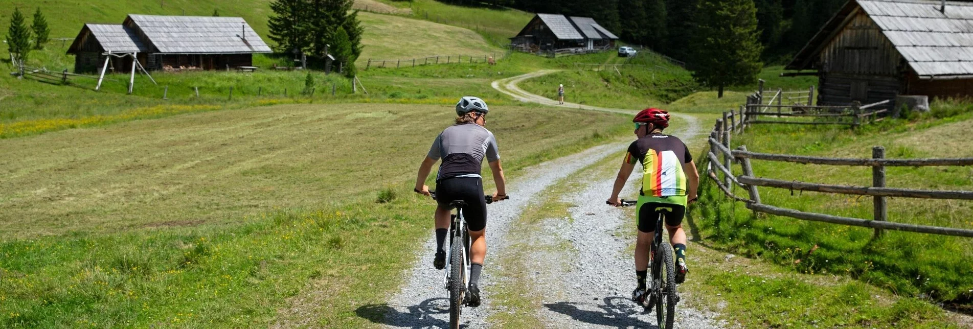
Mountain Biking Tour 4b - MTB  - Hölleralmrunde - Touren-Impression #1 | © Gästeverein Hohentauern Mountain Biking Tour 4b - MTB  - Hölleralmrunde - Touren-Impression #1 | © Gästeverein Hohentauern

Tour 4b - MTB - Hölleralmrunde

Open
A mountain bike trail in the middle of nature away from road traffic in the Murtal adventure region in styria.  Good basic condition required. Basic technical knowledge is sufficient.

Starting point of the tour is the toll station of the Edelrautestraße in Hohentauern in the adventure region Murtal in styria. From here turn right, now on the well-marked forest road steadily uphill to a junction. Here you can either branch off to the Hölleralmhütte (approx. 300m) and enjoy the fantastic alpine area on your mountain bike or continue uphill towards the Edelrautehütte. After about 2.3 km on the forest road, the tour joins the toll road. Now four more hairpin bends and a crisp finale to the Edelrautehütte. The way back is either the same way or on the toll road (gravel road).

If you really drive the entire tracked tour, it is about 22.6 km - but at least 14.7 km. Opening times of the tours must be observed!


Characteristics

Skill
Fitness

Best season

January
February
March
April
October
November
December

The tour in numbers

medium
Level of difficulty
11,5 km
Route
2:30 h
Time
630 hm
Uphill
630 hm
Downhill
1685 m
Highest point

Map & downloads

More information

B114, coming from Trieben - 100 m after the town sign turn right over the Neue Tauernstraße, direction Mautstraße.

B114 coming from St.Johann - 100 m before the town sign turn left over the Neue Tauernstraße, direction Mautstraße.

The starting point of the tour is the parking lot at the pile-dwelling village. From here continue to the tollbooth. Turn right before the tollbooth, now always follow the Hohentauern bike tour signs. Now it goes steeply uphill again and again, then you come to a fork, turn right and ride about 300m to the alpine pasture. After a flat stretch it now goes to the toll road and there is the possibility also here turn right in the direction of Edelrautehütte.

The stop at the Hölleramlhütte and Edelrautehütte is simply part of this tour! 
This tour is NOT considered "accessible by train and bus" because there is no regular connection.

Taxi Kandler Georg, 8785 Hohentauern

https://www.tttaxi.at/  

You can then park at the pile-dwelling village

More information about the "Nimm's Radl" bike node system Murtal is available at www.murtal.at.

The bike map and the bike tour booklet are available at all locations of the Tourist Association Murtal and at many businesses in the region

More information about bike and MTB routes you can find here www.murtal.at 

Information about mountain biking in Hohentauern and the Murtal region can be found on our homepage www.murtal.at  

Gallery

What the weather will be like

Hohentauern (1272m)

Morning
foggy
6°C
70%
5 km/h
Noon
weather.icon.66
6°C
90%
10 km/h
Night
weather.icon.66
5°C
85%
10 km/h
Throughout the day more and more rain with hardly any breaks.
Morning
foggy
5°C
60%
5 km/h
Noon
cloudy
13°C
35%
5 km/h
Night
slightly cloudy
10°C
45%
5 km/h
Rain and rain showers will end around noon. Dry with a chance of sunny spells afterwards.
05.05.2024
cloudy
5°C 16°C
06.05.2024
cloudy
6°C 17°C
07.05.2024
foggy
6°C 13°C

Nearby accommodation options

Continue to search

You may also be interested in

Recommended tours

Accessible by public transport
Wo gehts weiter? Unsere Nimm´s Radl und Mountainbike Karte hilft weiter | Tom Lamm | © Erlebnisregion Murtal
Murtal medium Open
Route 11,4 km
Duration 1:35 h

Tour 4a -MTB - Triebensteinrunde

Accessible by public transport
Hoch über dem Triebental | Guenter Lanz | © Erlebnisregion Murtal
Murtal medium Open
Route 11,4 km
Duration 1:50 h

Tour H1 - MTB - Hasensattel

Accessible by public transport
MTB fahren | Tom Lamm | © Erlebnisregion Murtal
Murtal medium Open
Route 10,9 km
Duration 1:30 h

Tour - MTB - Hasensattel

Accessible by public transport
Wichtelhütte Hohentauern | Herbert Raffalt | © Verein Hohentauern
Murtal medium Open
Route 7,5 km
Duration 1:00 h

Tour H3 - MTB - Wichtelhütte