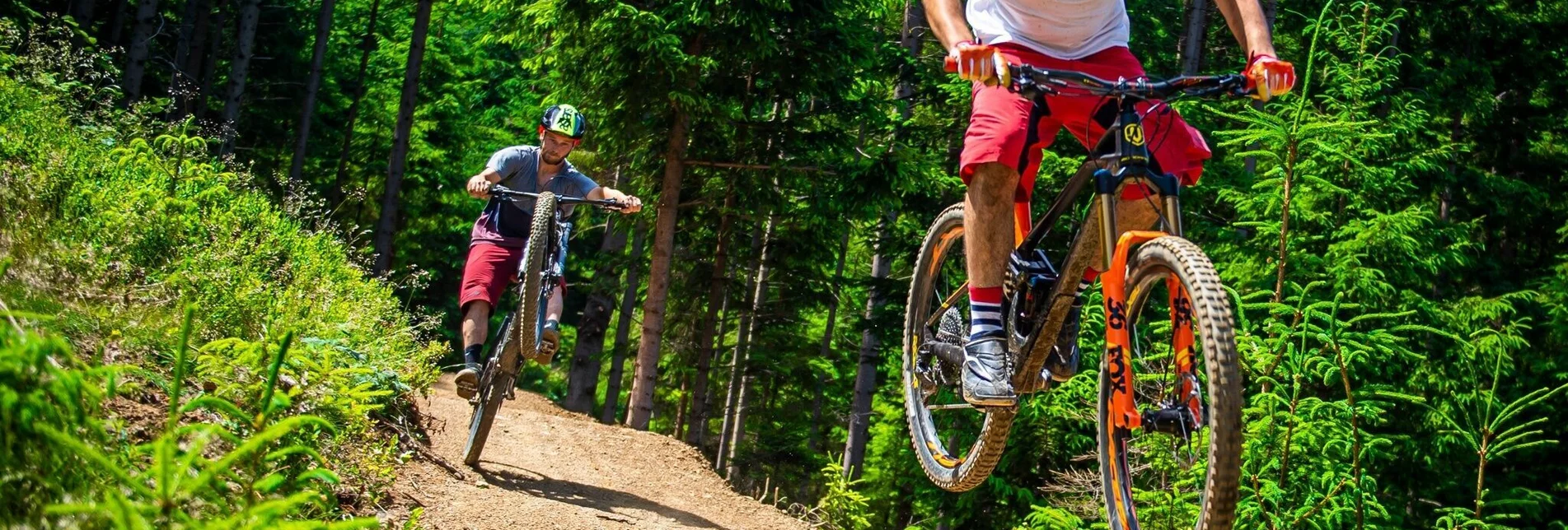
Mountain Biking Tour 67f -MTB - Fuchs und Henne Trail - Touren-Impression #1 | © MTB Region Murtal Mountain Biking Tour 67f -MTB - Fuchs und Henne Trail - Touren-Impression #1 | © MTB Region Murtal

Tour 67f -MTB - Fuchs und Henne Trail

Open

The Fux & Henne Trail has its starting and end point at the wonderful Wipfelwanderweg in Rachau in the Murtal Styria adventure region. The natural trail can be reached via the Roatmoaralm Tour or the Hoferalm Tour (well signposted) and can also be combined with the equally natural Hoferalm Trail. After the trail fun, a stop at the Fuchs und Henne snack station of the same name on the former Wipfelwanderweg hiking trail is not to be missed.

On this tour, we start at the Wipfelwanderweg car park at junction 67 and head off to the right for 600m until we reach the Kischbauer junction, where we turn left in the direction of Rösslergraben and ride comfortably uphill on the asphalt road along the stream until we reach the Hoferhütte turn-off on the left. At the bridge and at the sign, there is often an indication whether the Hoferhütte is open. Now follow the gravel path uphill through the forest, past bee huts to the hill in front of the Hoferhütte. It is essential to find time for a photo stop in the Murtal valley before you are treated to a good snack, soup or cake at the Hoferhütte. Since the hut is only open on weekends, there is a small earth cellar and you don't have to do without chilled drinks.  After the hut, take the jagged trail on the right downhill (experienced bikers) to the starting point. The combination with a visit to the Wipfelwanderweg is obvious - or a stop directly at the Jausenstation Fuchs & Henne in the Erlebnisregion Murtal Steiermark.

Characteristics

Skill
Fitness
Experience
Scenery

Best season

January
February
March
November
December

The tour in numbers

medium
Level of difficulty
3,1 km
Route
0:15 h
Time
13 hm
Uphill
380 hm
Downhill
1112 m
Highest point
732 m
Lowest point

Map & downloads

More information

If you take the Knittelfeld OST exit, the Wipfelwanderweg is signposted from Knittelfeld. Please always continue in the direction of Rachau or St. Margarethen bei Knittelfeld and then turn right onto Gleinstraße in St. Margarethen. We recommend that you always stay in the direction of Rachau bei Knittelfeld, as the access road to the Wipfelwanderweg Rachau is located near the entrance to the village/exit of Rachau.

Most navigation systems will direct you via a somewhat longer and complicated approach route to the Wipfelwanderweg when you enter "Mitterbach 25". We therefore recommend entering the address "Rachau 97" (= Gemeindeamt Rachau), as this will take you directly in the direction of Rachau and you will not be able to miss the Gleinstraße or the turn-off from there to the Wipfelwanderweg Rachau due to the signs.

MTB tour with great views of the Murtal and chilled fresh drinks. (Don't forget to bring change), stop at the Jausenstation Fuchs & Henne on the Wipfelwanderweg.

Easily accessible from Knittelfeld station via St.Margarethen in the direction of Rachau.
Wipfelwanderweg car park & Fuchs und Henne restaurant

More information about the "Nimm's Radl" Murtal cycle node system is available at www.murtal.at.

Gallery

What the weather will be like

St. Margarethen bei Knittelfeld (633m)

Morning
sunny
9°C
0%
0 km/h
Noon
sunny
22°C
0%
10 km/h
Night
very sunny
19°C
0%
5 km/h
Early clouds will clear to leave the region with a dry and sunny day.
Morning
very sunny
11°C
0%
0 km/h
Noon
very sunny
23°C
0%
10 km/h
Night
very sunny
18°C
0%
5 km/h
Dry and sunny throughout the day with hardly any clouds.
01.05.2024
sunny
6°C 21°C
02.05.2024
cloudy
9°C 17°C
03.05.2024
foggy
8°C 15°C

Nearby accommodation options

Continue to search

You may also be interested in

Recommended tours

Accessible by public transport
Lucas Pripfl | © ARGE Mountainbike - Murtal
Murtal medium Open
Route 14,3 km
Duration 1:30 h

Tour 67e - MTB - Murtalblick round long

Mountainbike | Manuela Machner | © Erlebnisregion Murtal
Murtal medium Open
Route 13,1 km
Duration 1:50 h

MTB - Tour - Tobiasalm

Accessible by public transport
Steinplan Mountainbike | Anita Fössl | © Erlebnisregion Murtal
Murtal challenging Open
Route 29,7 km
Duration 1:00 h

MTB - Tour 67d - Steinplan starting from Gobernitz

Accessible by public transport
Lucas Pripfl | © ARGE Mountainbike - Murtal
Murtal medium Open
Route 20,8 km
Duration 1:30 h

Tour 67b - MTB - Hofer-Alm - trail included

Steinplan Mountainbike | Anita Fössl | © Erlebnisregion Murtal
Murtal challenging Open
Route 12,9 km
Duration 2:40 h

MTB Tour 59k- Steinplan via Kleinlobming

Accessible by public transport
MTB & Rad Touren Karte | Tom Lamm | © Erlebnisregion Murtal
Knittelfeld medium Open
Route 10,6 km
Duration 1:30 h

Thalberg-Runde

Accessible by public transport
Mountainbike auf die Möschbauertour | Anita Fössl | © Erlebnisregion Murtal
Murtal medium Open
Route 25,1 km
Duration 2:30 h

Tour 67c- MTB- Möschbauertour